Mapping high conservation value forests in Sweden – implementation of a landscape model for green infrastructure
The probability of forest with high conservation value represents tool for landscape planning. It will be developed together with relevant stakeholders to ensure its implementation in green infrastructure at regional and national level.
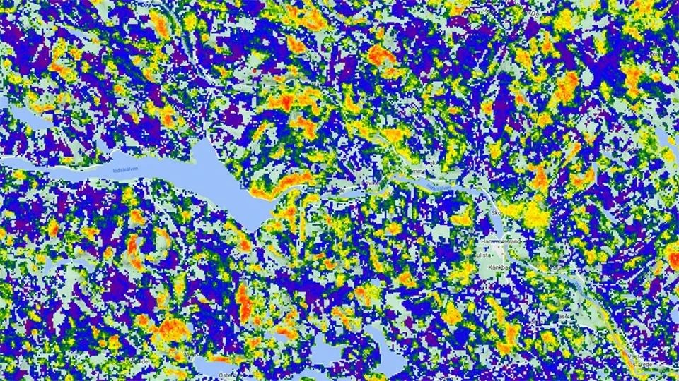
The derived map of high conservation value forests can support spatial prioritization of future protected areas and identify areas suitable for forest biodiversity restoration. It also provides information on landscapes with a pronounced history of forestry where conflicts between forest harvesting and conservation are limited and where forestry business as usual or in adapted form can be understood.
We foresee that the model has a large potential to support green infrastructure planning on multiple scales, forest management planning, serve as a basis for field inventory and further research, as well as for providing public information and citizen engagement. The model is finalized, but for application as an effective tool it remains to be further discussed, adapted and anchored with relevant stakeholders.
Hence, the aim with this project is to through information, dialogue and cooperation develop the model into an applied tool for strategic and tactical green infrastructure planning. This includes
- Creating an open website that provide the model in a suitable GIS-format that is harmonized with the systems that are used by various end users and that includes a detailed manual and shorter briefs tuned to different user categories.
- Complement the website https://bubnicki.users.earthengine.app/view/swedentest with needed information for its applied use
- Perform expert validation for selected areas together with relevant persons at the regional County Boards and the Forest Agency
- Identify a long-term host for tool to ensure possibility for future updating and development, including the combined use of other existing geographical databases such as the national land cover database.
- Explore the option to create a portable app for general public (citizens science) that allow reporting of natural values from areas with predicted high probability of being of conservation value.
Facts
Project period
230201-240131
Subjects
Research groups
Project leader

Project members

Funders